
Warfare has shifted dramatically over the last century, moving away from traditional ground-based confrontations to highly sophisticated, technology-driven operations.
Satellites, once confined to science fiction and Cold War reconnaissance, now sit at the core of strategic military planning.
Acting as ever-watchful “eyes in the sky,” military satellites deliver intelligence, navigation, communication, and early warning capabilities.
The purpose here is to examine the functions of military satellites, their strategic value in global conflicts, and the evolving geopolitical implications that surround their deployment and use.
Types and Functions of Military Satellites
Military satellites fulfill essential tactical and strategic missions, each built to serve a specific operational purpose.
As modern warfare becomes increasingly reliant on precision, speed, and coordination, these satellites provide indispensable support across various military domains.
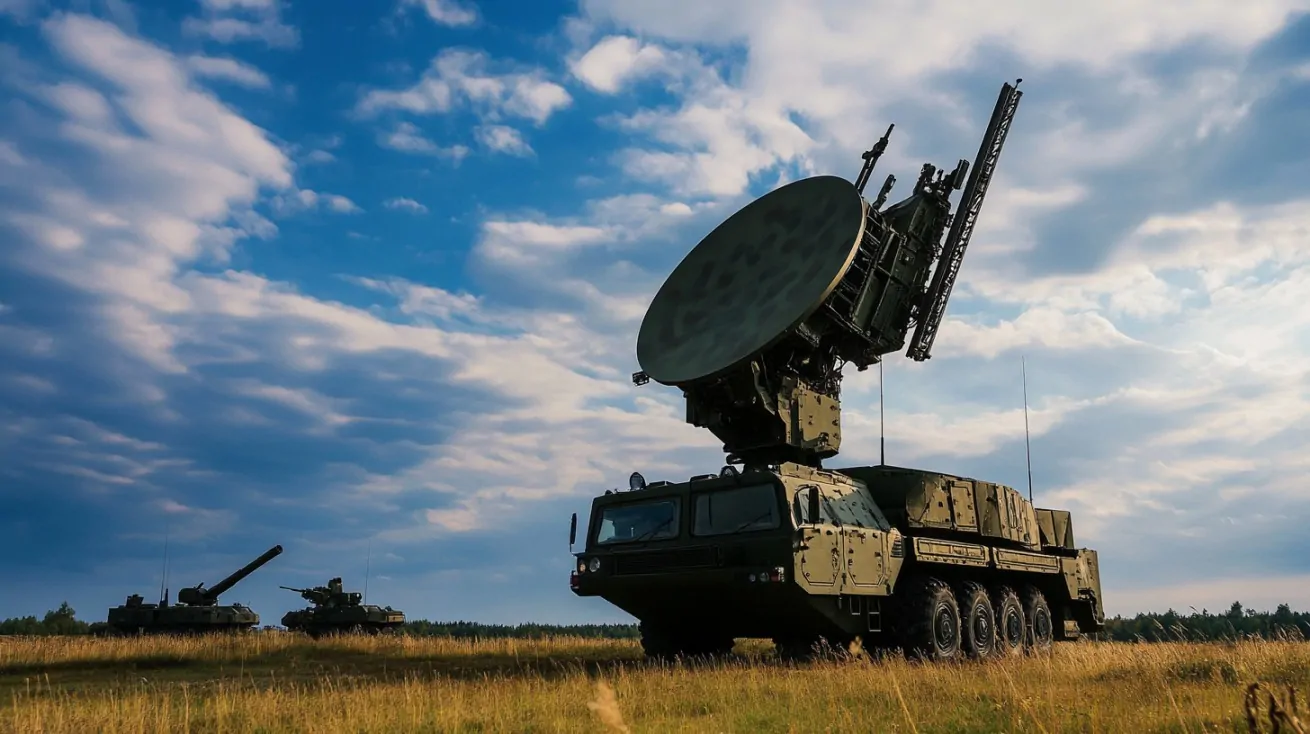
Reconnaissance/Spy
Intelligence gathering remains a foundational element in strategic defense.
Reconnaissance satellites, often equipped with optical, infrared, and radar sensors, monitor enemy movements, installations, and technological developments without alerting targets.
- Capturing high-resolution optical imagery of surface-level activities.
- Conducting thermal scans to identify camouflaged or nighttime operations.
- Detecting missile test sites, underground facilities, and military infrastructure.
- Supporting long-term monitoring of geopolitical hotspots.
Platforms such as the U.S. KH-series and China’s Yaogan satellites enable detailed surveillance from high Earth orbits, producing critical data for decision-makers and analysts.
Communication
Coordinated operations rely heavily on uninterrupted, secure communication.
- Command centers
- Aircraft
- Ships
- Ground forces
Essential roles of communication satellites:
- Relaying real-time voice, video, and data feeds across continents.
- Providing resilient communication links during cyber or kinetic disruptions.
- Supporting unmanned vehicle control and battlefield robotics.
- Enabling high-security conferencing between leadership and field units.
Examples include the U.S. Advanced Extremely High Frequency (AEHF) system, which supports nuclear command and control among other functions.
Navigation
Accuracy in targeting, movement, and resource allocation defines successful modern campaigns. Navigation satellites underpin systems used in artillery strikes, air sorties, and convoy movements.
- Delivering GPS guidance for smart munitions, such as JDAMs and cruise missiles.
- Assisting troops in terrain coordination and search operations.
- Guiding naval vessels through strategic passages with minimal error.
- Providing time synchronization for encrypted communication networks.
Navstar GPS, operated by the U.S. Space Force, represents the backbone of allied navigation support, with global reach and unmatched precision.
Early Warning Systems
Early warning satellites function as the first line of detection against nuclear or ballistic threats.
Positioned in geostationary or highly elliptical orbits, they use advanced sensors to detect heat and infrared signatures emitted during missile launches.
- Identifying intercontinental ballistic missile (ICBM) launches seconds after ignition.
- Tracking launch trajectories to assess potential impact zones.
- Alerting air defense systems for intercept planning.
- Monitoring nuclear detonation activity on a global scale.
Programs like the U.S. Defense Support Program (DSP) and the Space-Based Infrared System (SBIRS) are instrumental in ensuring national defense readiness and deterrence posture.
Weather
Environmental factors directly affect mission outcomes. Weather satellites provide military planners with real-time data to support operational decisions, troop deployments, and logistics.
- Monitoring cloud cover, rainfall, and storm development that could impede air operations.
- Tracking ocean conditions relevant to naval movement and amphibious landings.
- Forecasting sandstorms, snowstorms, or fog for land-based missions.
- Supporting humanitarian missions by assessing affected zones post-disaster.
Satellites like the U.S. Defense Meteorological Satellite Program (DMSP) and India’s INSAT series provide meteorological data that reduces uncertainty and enhances mission safety.
Strategic Significance in Modern Warfare

Military satellites provide substantial tactical leverage in modern conflicts, shifting the dynamics of battlefield awareness, precision targeting, national security, and even disaster response.
Their influence shapes strategic outcomes, making them essential tools in both offensive and defensive operations.
Enhanced Situational Awareness
Real-time intelligence gathered through satellite systems enables commanders to make immediate, informed decisions on the battlefield.
Live imaging and infrared data feed into central command systems, allowing for comprehensive views of enemy movement, terrain changes, and potential threats.
- Live imaging of terrain and enemy formations
- Thermal and infrared scanning to detect hidden units or night movements
- Continuous mapping updates that inform logistics and strategy
Such awareness transforms operations from reactive to proactive, enabling faster adaptation and minimizing surprise.
Force Multiplier
When satellite systems are synchronized with advanced technologies, combat efficiency surges dramatically.
Precision-guided munitions depend on navigation and timing data transmitted by satellites. Autonomous vehicles and drones require geospatial inputs to identify, track, and neutralize targets.
- Laser-guided bombs and air-to-ground missiles using GPS signals
- Unmanned Aerial Vehicles (UAVs) receiving satellite-fed coordinates
- AI-assisted target recognition dependent on high-resolution satellite imagery
With this integration, fewer troops can execute more impactful missions, reducing human risk while increasing strategic impact.
Border and Coastal Surveillance
Nations facing territorial tensions depend heavily on satellites for monitoring borders and coastline activity. India provides a clear example of satellite utility in regional security, using a growing arsenal of specialized orbital systems.
- Cartosat-2A – delivers high-resolution optical imaging for ground surveillance
- GSAT-7 – enhances naval communications for real-time maritime coordination
- EMISAT – supports electronic intelligence and radar monitoring of border zones
These tools allow India to track incursions, monitor military infrastructure developments in neighboring countries, and maintain continuous observation of sensitive regions.
Disaster Response and Dual-Use Capabilities
Military satellites are not confined to conflict scenarios. In peacetime or during natural disasters, many are deployed for civilian support.
When earthquakes, cyclones, or floods strike, satellite imagery guides first responders and civilian authorities in damage assessment and logistical planning.
- Rapid mapping of affected areas for rescue missions
- Monitoring of wildfire spread and forest health
- Real-time weather pattern observation aiding evacuation strategies
Resources originally designed for defense thus become vital tools in protecting civilian life and infrastructure during emergencies.
Global Overview and Country-Wise Capabilities

Military satellite power reflects geopolitical clout, technological capacity, and defense priorities.
Space-based assets offer a silent but significant indicator of national ambitions and readiness.
Leading powers use their satellite fleets for functions that range from surveillance and early warning to communication and strategic deterrence.
United States
.@USSF_SSC, a Field Command of #SpaceForce, has certified the Vulcan launch system for national security missions. Congratulations to the team! #SemperSupra
Learn more: 👇https://t.co/EBMP1MdEo9
— United States Space Force (@SpaceForceDoD) March 29, 2025
Operating approximately 123 dedicated military satellites, the United States commands the most extensive and technologically advanced orbital defense infrastructure.
Dominance in space is driven by sustained investment and integration of civilian, military, and intelligence agencies under cohesive command structures like the United States Space Force and the National Reconnaissance Office (NRO).
- KH-11 and successors provide real-time, high-resolution imaging.
- Defense Support Program (DSP) and Space-Based Infrared System (SBIRS) monitor missile threats worldwide.
- GPS network underpins precision-guided munitions and allied operations.
- Advanced Extremely High Frequency (AEHF) satellites offer hardened, jam-resistant global communication links.
- Ongoing upgrades protect space assets from hostile interference and jamming.
Strategic foresight ensures continuous modernization, with growing collaboration between private aerospace firms and the Department of Defense.
Russia
🚨🇷🇺 RUSSIA EXPANDS MILITARY SATELLITE NETWORK
Launch Details: On March 16, 13:50 Moscow time, Russia’s Ministry of Defense successfully launched several military satellites from the Plesetsk Cosmodrome using an Angara-1.2 rocket.
🔹Strategic Expansion: This mission continues… pic.twitter.com/9QclRYZ77I
— Info Room (@InfoR00M) March 17, 2025
Russia operates approximately 74 military satellites, maintaining a solid second-tier presence in military space operations.
Despite resource constraints and post-Soviet setbacks, Russia prioritizes space-based intelligence and ballistic missile early warning systems.
- Persona and Bars-M satellites support tactical reconnaissance.
- Liana system gathers signal-based intelligence across land and sea.
- Tundra-class satellites bolster missile launch detection capabilities.
- GLONASS network provides positioning data for military platforms.
- Historical development in counter-space systems fuels focus on ASAT and jamming technologies.
Strategic objectives emphasize survivability, with redundant systems and mobile ground control stations in place to ensure operational continuity under threat.
China
In the event of a conflict over Taiwan, China hopes to knock U.S. satellites out of commission. Not only would radio-frequency jammers be used, but ground-based laser weapons are being developed. pic.twitter.com/umjUx2gb86
— US Ship of State (@US_ShipOfState) April 4, 2025
China’s space military ambitions have accelerated, with nearly 68 military satellites deployed in recent years. National programs benefit from state-directed research and synchronized civil-military fusion strategies.
Emphasis falls on developing autonomous surveillance and robust regional capabilities to support maritime ambitions and border enforcement.
- Yaogan series supports high-resolution optical, radar, and signal interception.
- Tianhui and Haiyang satellites assist with ship monitoring and maritime patrol.
- Tianlian relay network and military versions of Beidou provide encrypted channels.
- Activities suggest development of jamming and offensive cyber operations via space assets.
- Ground-based and co-orbital weapons tested to demonstrate denial capability.
Deployment strategy indicates intent to secure dominance in the Asia-Pacific and minimize reliance on foreign systems.
India
India’s military-grade satellite, made by Tata placed in orbit. #TSAT-1A #SpaceXhttps://t.co/ZCSPMXWi2n
— Business Today (@business_today) April 9, 2024
India’s growing portfolio signals an intent to establish credible space-based defense capabilities.
While still catching up in volume, quality and precision have improved significantly. Current assets span surveillance, navigation, communication, and signal interception tailored for regional conflicts and asymmetric threats.
- Cartosat and RISAT satellites deliver high-resolution and synthetic aperture radar images for military intelligence.
- EMISAT detects radar emissions, aiding in signal intelligence and targeting.
- GSAT-6 and GSAT-7 serve army, air force, and navy communications.
- IRNSS/NavIC system supports precision operations in the subcontinent.
- Mission Shakti showcased capability to neutralize low Earth orbit satellites.
Policy direction focuses on enhancing strategic autonomy and integrating space assets with conventional forces to deter threats along contentious borders with China and Pakistan.
The Bottom Line
Military satellites shape modern warfare through intelligence, navigation, communication, and surveillance. Their integration into defense strategies transforms how nations defend, deter, and dominate.
Challenges such as cybersecurity threats, space debris, and ASAT weapons require careful oversight. Striking a balance between technological advancement and diplomatic responsibility will shape the future of space-based defense systems.
Ensuring readiness while promoting responsible policy remains essential in maintaining security and stability under the ever-watchful eyes in the sky.